Shipping Estimate
USA
- USA
- CAN
- USA
- CAN
Ships within 48 hours · Estimated delivery Jul 6 - Jul 11
For Your Every Summer RSVP, with Code: SUMMER15
Description
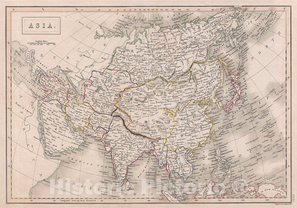
Historic Map : Black Map of Asia, 1840, Vintage Wall ArtAdam and Charles Black's 1840 map of Asia. The map covers the entire Asian continent from the Arctic Ocean to the Indian Ocean and from the Mediterranean Sea to the North Pacific Ocean. It shows Turkey, Arabia, Persia, the Indian subcontinent, Russia, the Chinese empire, Japan and parts of Southeast Asia. Also shows the uninhabited island of Nova Zembla in the Arctic Ocean. In the early 19th century Asia was coming under increasingly imperial european
Adam and Charles Black's 1840 map of Asia. The map covers the entire Asian continent from the Arctic Ocean to the Indian Ocean and from the Mediterranean Sea to the North Pacific Ocean. It shows Turkey, Arabia, Persia, the Indian subcontinent, Russia, the Chinese empire, Japan and parts of Southeast Asia. Also shows the uninhabited island of Nova Zembla in the Arctic Ocean. In the early 19th century Asia was coming under increasingly imperial european sway. In India full British rule allowed england to attain naval and trade supremacy throughout the eastern Hemisphere. Using India as a springboard, the english traded wool and Indian cotton for Chinese tea and textiles. By the 1830s oversaturation of the Chinese market slackened Chinese demand for most British products. To make up for the trade deficit, British merchants introduced Indian opium to China. Addictive and cheap, Opium became Britain's most profitable and important crop in world markets, pouring into China faster than tea poured into Britain. Opium addiction and its attendant social ills reached such catastrophic levels that the Chinese government took action and destroyed British opium stores in Canton. As this threatened english commercial interests, the crown responded, sparking the Opium Wars of 1839-1842. The superior British forces took complete control of Canton, occupied Shanghai, and blockaded Chinese ports, forcing the Chinese to sign the 1842 Treaty of Nanking. This unequal treaty (the first of many between european powers and China) granted Britain extensive trading rights in China. This map was engraved by S. Hall for issue in the 1840 edition of Black's General Atlas.
Shipping Notes
- Free Standard Shipping on $100+ Orders to the USA.
- Except Preorder products are shipped in 48 hours.
- Delivery to the USA:
- Standard Shipping : 3-10 business days
- If time is of the essence, please consider selecting expedited delivery for faster service.
Exchange/Return Notes
- We offer a 30-day return/exchange service after receiving.
- Final sale items are not eligible for returns or exchanges.
- To process your return/exchange, please contact us at [email protected]
- Please click here for more details>>> Return & Exchange Policy